
The Ultimate Guide To The World’s Best Trekking Destinations
- Leave a Comment
- Diya S
- July 12, 2024
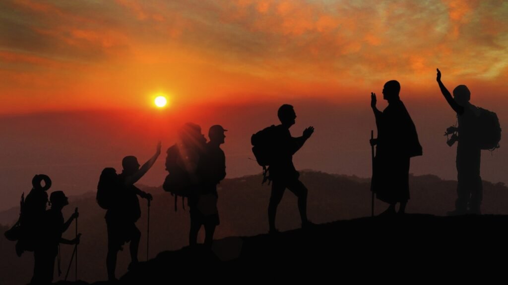
Trekking is more than simply a physical activity; it’s an adventure into the heart of the natural environment, an endurance test, and an incredibly fulfilling experience that helps us re-establish a connection with it.
Trekking provides unmatched possibilities to view stunning vistas and immerse oneself in varied ecosystems, whether one chooses to walk along tranquil coastlines, climb difficult mountains, or traverse dense forests.
Trekking is appealing not just because it’s an exciting and physically demanding activity, but also because it promotes a deep sense of peace and connectedness to the natural world.
This site seeks to assist both experienced and inexperienced hikers in learning about some of the world’s most breathtaking hiking locations.
These routes, which connect the old Inca pathways with the majestic peaks of the Himalayas, provide breathtaking views and life-changing experiences.
Our well considered selection of the top 10 trekking destinations will inspire your next adventure and assist you in organizing a trip that will have a lasting impression, whether your goal is a strenuous high-altitude trek or a beautiful, leisurely ramble.
Come along as we explore these amazing paths and discover the wonder and excitement that await at each turn.
1. Nepal's Everest Base Camp

One of the most famous and sought-after treks in the world for hikers is to reach Everest Base Camp. Depending on the chosen itinerary and pace, the trek, which spans around 130 kilometers (80 miles) round trip, can be finished in 12 to 14 days on average.
This demanding journey begins in the town of Lukla, which is reachable from Kathmandu with a quick flight.
The trail ascends through a variety of environments, including lush forests, suspension bridges, and high-altitude deserts, as it snakes through the breathtaking Khumbu Valley from Lukla.
Trekkers should be physically and mentally prepared for the relatively challenging terrain, steep ascents, and high elevations they will encounter.
Trekking to Everest Base Camp is well known for its breathtaking scenery and diverse cultural experiences. Trekkers can enjoy expansive views of some of the highest peaks in the world, such as Mount Everest, Lhotse, and Nuptse.
The trip also presents a special chance to become fully immersed in the colorful Sherpa culture. Trekkers can engage with the kind and welcoming locals while touring historic monasteries and traditional Sherpa communities.
Reaching Everest Base Camp, located at 5,364 meters (17,598 feet) above sea level, where climbers from all over the world train for their ascent to the peak of the highest mountain in the world, is without a doubt the pinnacle of the journey.
We recommend that you start your Everest Base Camp hike in the spring or fall, just before or after the monsoon.
Trekking is best done between March and May when the weather is usually consistent and the temperatures are reasonable. The rhododendron forests are in full flower during this time, bringing brilliant hues to the surroundings.
Another great time to trek is from September to November when the surrounding peaks are beautifully visible under a clear sky and the air is crisp. The optimum weather for a secure and enjoyable trekking trip is available during these months.
Trekking to Everest Base Camp requires acclimatization because the high altitude can be extremely dangerous to one’s health. It is imperative that you ascend gradually so that your body can get used to the decreasing air pressure.
To help with acclimatization, schedule rest days at important locations like Dingboche and Namche Bazaar.
Make sure you have everything you’ll need, such as warm clothes, a high-quality sleeping bag, and durable trekking boots. Furthermore, you’ll need trekking permits, which may be acquired in Kathmandu.
Examples of these include the Sagarmatha National Park permit and the TIMS (Trekkers’ Information Management System) card. Making the most of your time at Everest Base Camp requires you to stay hydrated, hike at a steady pace, and pay attention to your body.
2. Peru's Inca Trail

One of the most well-known walking paths in the world, the Inca Trail takes hikers through the magnificent Andes to the historic citadel of Machu Picchu.
It usually takes four days to finish the approximately 42 kilometers (26 miles) of this historic trail.
The journey starts close to Ollantaytambo and passes through a range of environments, including as subtropical jungle, alpine tundra, and cloud forests.
At the Dead Woman’s Pass, the trail reaches a maximum elevation of 4,215 meters (13,828 feet), making it a moderately demanding hike with multiple steep ascents and descents.
To take on this difficult but incredibly rewarding walk, one must possess a strong level of physical fitness and endurance.
Famous for both its breathtaking natural beauty and significant historical background is the Inca Trail. Trekkers will come across several well-preserved Inca ruins along the way, including as Patallacta, Runkurakay, and Wiñay Wayna, which provide an intriguing look into the past.
The trail’s many ecosystems offer a constantly shifting landscape of verdant forests, snow-capped mountains, and charming valleys.
Trekkers are greeted with a stunning view of the famous ruins bathed in the golden morning light when they enter Machu Picchu through the majestic Sun Gate (Inti Punku) before daybreak. This is the trek’s final climax.
The dry season (April through October) is the ideal time of year to hike the Inca Trail. Trekking is best done in these months because of the generally more consistent weather, which includes clear skies and less precipitation.
While the weather is at its best from June to August, which is also the busiest trekking season, the trail may get extremely congested.
Trekking in April, May, September, or October is a good option if you want a more sedate experience. The weather is still nice but there are fewer hikers during these months.
Since the Peruvian government rigorously limits the number of trekkers to 500 per day, including guides and porters, reservations for the Inca Trail must be made well in advance.
Particularly during the busiest time of year, permits frequently sell out months in advance. Another important aspect of the Inca Trail is how to handle altitude.
To lower the danger of altitude sickness, it is recommended to spend a few days acclimating in Cusco or the Sacred Valley prior to beginning the climb.
Other strategies to help control the effects of altitude include eating light meals, pacing yourself, and staying hydrated. Properly preparing for a hike requires bringing along essentials like a high-quality sleeping bag, layered clothes, and sturdy hiking boots.
3. Chile's Torres del Paine

Nestled in the southernmost point of Chilean Patagonia, the Torres del Paine National Park is widely recognized for its breathtaking scenery and strenuous hiking paths.
The “W Trek,” the most well-known trekking circuit, is roughly 70 kilometers (43 miles) long and usually takes 4 to 5 days to finish. This hike offers a wide variety of scenery, including enormous granite peaks, azure lakes, old glaciers, and broad valleys.
It’s a somewhat tough landscape with a variety of well-marked routes and rocky, uneven surfaces. Hikers should be ready for erratic weather, which might include chilly temperatures and high winds.
The breathtaking Patagonian scenery of Torres del Paine are one of its primary attractions. Trekkers are rewarded with expansive vistas of the park’s most famous features, such as the majestic Cuernos del Paine (Horns of Paine) and the tall granite spires of Torres del Paine (Towers of Paine).
Along with a wide variety of other animals, the park is home to guanacos, foxes, condors, and, with any hope, pumas. The hike provides opportunity to see old glaciers up close, like the Grey Glacier, which flows into Grey Lake and has a stunning blue color.
The summer months in the Southern Hemisphere, which run from November to early March, are the ideal times to explore Torres del Paine.
The weather is generally pleasant during this time of year, with longer daylight hours and fewer chances of precipitation.
The trails are also easier to access because, in the winter, snow and ice may cause certain places to be closed or difficult to travel.
Since January and February are the busiest travel months with more tourists, it’s best to reserve lodging and campsites ahead of time for a more seamless experience.
Since Patagonia’s weather may be very unpredictable, it is imperative to be prepared for the weather when walking in Torres del Paine.
Bring layers of clothing that can withstand different temperatures and weather, such as outer layers that are windproof and waterproof.
Because of the potentially difficult and uneven terrain, high-quality hiking footwear with adequate ankle support are essential.
Along the W Trek, campers have a variety of options, from fully furnished refugios (lodges) to designated campsites with modest amenities.
It is best to reserve campsites or refugios in advance, especially at the busiest times of the year, to ensure a place to stay and food options. Carry enough food and a trustworthy map or GPS gadget as well, since there may be areas of the park where phone service is spotty.
It is ensured that this pristine environment will be preserved for enjoyment by future generations by adhering to park regulations and the Leave No Trace philosophy.
4. France, Switzerland, and the Haute Route

The Haute Route, often known as the “High Route,” is a well-known trekking path that links Zermatt, Switzerland, with Chamonix, France, and passes through the breathtaking Alps.
This strenuous hike takes around 10 to 12 days to finish and spans roughly 180 kilometers (112 miles).
The path offers stunning views of prominent peaks like Mont Blanc and the Matterhorn and crosses high mountain passes, including the well-known Col de la Haute path.
The terrain varies from rough and snowy roads to well-marked trails, thus mountain trekking experience and a reasonable degree of fitness are must.
Renowned for its breathtaking alpine landscape, the Haute Route features large glaciers, towering peaks, and verdant meadows adorned with wildflowers. Trekkers are rewarded with expansive vistas of glistening alpine lakes reflecting snow-capped mountains.
Hikers will come across quaint mountain towns like Verbier and Zinal in Switzerland and Les Houches and Champex in France along the way, all rich in regional culture and customs. The hike offers the chance to see the abundant animals of the area, such as marmots, chamois, and ibex.
The summer months of June through September are the ideal times to hike the Haute Route. Trekking is made easier by the extended daylight hours and often more steady weather during this time of year.
There’s less chance of encountering hazardous weather because mountain passes are more accessible and snow levels are usually lower. With the greatest weather, July and August are the busiest months for trekking. However, trekkers should be ready for congested paths and reserved lodging.
Because the Haute Route travels through inaccessible and difficult terrain, careful planning and preparation are essential for successful navigation.
To help in navigation, especially in places where trail signs may be few or weather conditions might change quickly, carry accurate maps, a compass, and ideally a GPS device. Get acquainted with the route and any detours in case of unforeseen obstacles or closures.
Along the Haute Route, lodging options vary from modestly equipped mountain huts (refuges) to upscale hotels and guesthouses found in bigger cities and villages.
To guarantee availability, it is advisable to reserve lodging in advance, particularly during the busiest times of the year. In the event that all refuges are booked or there are crises, think about packing a lightweight tent or bivouac supplies for flexibility.
Some of the settlements along the route provide food and provision resupply sites, but since services may be few in rural locations, it’s advisable to bring enough supplies for a few days, including hydration solutions and energy-dense foods.
5. Tanzania's Mount Kilimanjaro

Africa’s highest mountain, Mount Kilimanjaro, rises to a height of 5,895 meters (19,341 ft) above sea level. A remarkable adventure through a variety of environments, including lush rainforests, alpine deserts, and glaciers near the peak, can be had by trekking Mount Kilimanjaro.
The most popular path, the Marangu path, often called the “Coca-Cola Route,” takes around 5 to 6 days to complete and spans about 70 kilometers (43 miles) round way.
There are other routes that offer different lengths and degrees of difficulty, such as the Machame, Lemosho, and Rongai Routes. Some longer routes allow for better acclimatization.
Climbing Kilimanjaro is a great way to experience the varied climates and scenery of the mountain. The journey starts in the verdant rainforests on Kilimanjaro’s lower slopes, where hikers may come across rare kinds of birds and colobus monkeys, among other distinctive plants and animals.
The terrain changes through heath and moorland zones as height rises, with broad grasses and enormous lobelias as distinguishing features.
Trekkers reach the alpine desert zone at 4,000 meters (13,123 feet) elevation. Here, the terrain turns rough and desolate, preparing them for the last ascent across the breathtaking glaciers near the summit.
Perched atop Africa’s highest point, the summit experience itself offers unmatched views and a deep sense of accomplishment.
The dry seasons, which run from January to March and June to October, are the ideal periods to hike Mount Kilimanjaro. These times of year usually provide less precipitation, clearer skies, and more consistent weather, which increases the likelihood of a successful summit bid.
The best months to visit are January and February because of their clear visibility and less crowds. Even though it can get crowded in the summer, June to October is still a great time to visit because of the lower temperatures and clearer skies.
Steer clear of trekking in April through May and November through December during the rainy seasons. These times might present additional obstacles due to muddy and slippery terrain caused by excessive rains.
To tackle Kilimanjaro’s tough terrain and high altitude, physical preparation is essential. To increase endurance and stamina, jog, ride a bike, or go on frequent aerobic activity.
Leg and core strengthening exercises can also help you get ready for the ascents and descents. The key to lowering the risk of altitude sickness is gradual acclimatization.
Select a route like the Machame or Lemosho Routes, which are longer but have better success rates because of their better acclimatization profiles, that permits appropriate acclimatization with a steady increase in altitude.
Speak with knowledgeable tour operators and guides to choose the itinerary that best fits your interests and degree of fitness.
Pack layers of clothes that are appropriate for the temperature and conditions you will be in. These layers should include waterproof outerwear, insulating layers, and lightweight, moisture-wicking textiles. To navigate uneven terrain, high-quality hiking boots with ankle support are a must.
It’s important to be well hydrated when traveling at high elevations, so bring enough water with you and think about utilizing a hydration pack or pills to top off your water supply.
To ensure a safe and pleasurable climb up Kilimanjaro, keep a positive attitude and pay attention to your body during the journey. Allow for respite and changes as necessary.
6. Nepal's Annapurna Circuit

Trekkers can experience an amazing adventure across numerous landscapes and cultural settings on Nepal’s most popular and varied trekking route, the Annapurna Circuit.
The walk usually takes 15 to 20 days to complete, covering a distance of between 160 to 230 kilometers (100 to 145 miles), depending on the beginning and ending sites.
The path circles the Annapurna Massif, going through terraced rice terraces, dry high-altitude deserts, and verdant subtropical woods.
The Thorong La Pass, which is located at 5,416 meters (17,769 feet) and has multiple steep ascents and descents, makes the climb demanding, ranging from moderate to challenging. Due to the varied terrain and altitudes, planning and physical fitness are essential.
Trekkers traveling the Annapurna Circuit are rewarded with a plethora of varied landscape that changes considerably as they proceed.
The trail rises through alpine meadows and into the rocky, arid areas close to Thorong La Pass, having begun in the verdant valleys and subtropical woods.
One of the trek’s main highlights is this high-altitude crossing, which provides expansive vistas of the Dhaulagiri and Annapurna mountain ranges.
Trekkers experience equally enriching cultural experiences as they travel through traditional villages home to a variety of ethnic groups, including as the Gurungs, Manangis, and Thakalis.
These interactions offer an insight into regional traditions, way of life, and the friendly hospitality of the Nepalese people.
The spring and fall pre-monsoon and post-monsoon seasons are ideal for trekking the Annapurna Circuit. The springtime brings with it blossoming rhododendron forests and clear skies, making for a beautiful trekking backdrop from March to May.
The autumnal months of September through November provide steady weather, comfortable temps, and great views of the mountain tops.
These times of year are perfect for trekking since they offer good temperatures and little chance of precipitation, making for an enjoyable and fulfilling experience on the path.
The monsoon season, which runs from June to August, is best avoided because of the possibility of mudslides, landslides, and decreased visibility caused by heavy rains, which can make trekking risky and difficult.
The spring (March to May) and autumn (September to November) seasons are the best periods to walk the Annapurna Circuit. Rhododendrons are in blossom and the sky is clear in the spring, making for a colorful and lovely scenery for hikers.
Autumn is an even better time of year, with consistent weather, comfortable temps, and great views of the neighboring peaks. The ideal seasons for trekking are those with moderate temperatures and little precipitation.
It is best to avoid the winter months of December through February, when snow and bitter weather can make the trek difficult and certain routes impossible, and the monsoon season, which runs from June to August.
For a comfortable and secure trip over the Annapurna Circuit, it is imperative to pack basics. It’s essential to wear layered clothing to account for the vast variations in temperature experienced at various elevations.
Add insulating layers, base layers that wick away moisture, and an outer layer that is wind- and waterproof. To navigate rough terrain, you need hiking boots that are of good quality, broken in, and provide ankle support.
It’s also advised to bring trekking poles, a headlamp, a warm sleeping bag, and a strong backpack. Your pack should have basic first aid supplies, high-energy snacks, and hydration devices or water purification tablets.
Trekking can be made more enjoyable if you are aware of and respectful of local customs. Give a warm “Namaste,” a customary salutation that expresses respect, to the natives. To respect local culture, dress modestly, especially in villages and places of worship.
Consider the impact you have on the environment by adhering to the Leave No Trace philosophy, which includes picking up after yourself and reducing your footprint.
Encouraging neighborhood teahouses and stores along the way supports the local economy and offers a genuine cultural experience. Finally, think about hiring a local porter or guide to help with navigation and weight carrying as well as to learn more about the history and culture of the area.
7. USA's John Muir Trail

The John Muir track (JMT) is a well-known long-distance hiking track that winds through the Sierra Nevada mountain range in California for about 211 miles (340 kilometers).
The trail begins in Yosemite Valley and culminates at the 14,505-foot (4,421-meter) summit of Mount Whitney, the highest point in the contiguous United States.
The Sierra Nevada’s most breathtaking and secluded wilderness regions, including as Yosemite National Park, Sequoia National Park, and Kings Canyon National Park, are traversed by the JMT.
Due to its duration, high altitudes, and considerable elevation fluctuations, the trek is difficult and necessitates adequate physical preparation.
Hikers can enjoy breath-taking views of towering granite cliffs, glistening alpine lakes, verdant meadows, and deep woods along the John Muir Trail.
Hikers will pass by some of the most famous scenery in the Sierra Nevada, including Cathedral Peak, Half Dome, and the Evolution Basin.
A standout experience is being in the vast wilderness, since the JMT passes through gorgeous, secluded locations far away from the hustle and bustle of the outside world.
Numerous bird species, black bears, and mule deer are among the frequently sighted wildlife. This walk offers hikers a great sense of solitude and closeness to nature, making it an immensely fulfilling experience.
July through September is the ideal time of year to climb the John Muir Trail. The weather is usually consistent throughout this time of year, with milder temperatures and less precipitation.
The high passes’ snow has mostly melted, making the paths more usable. While August and September bring bright sky and milder temperatures, perfect for high-altitude trekking, July offers wildflower blossoms and fewer pests.
Because of the trail’s popularity, obtaining permits is mandatory and sometimes present difficulties, thus it is imperative to begin planning well in advance.
Getting permits is an essential part of preparing for your trek on the John Muir Trail. The National Park Service issues permits, which are necessary for overnight stays in the wilderness regions along the trail.
Since there is a lot of demand and the application period opens six months in advance, it is best to apply as soon as possible and be flexible with your start date. Permit applications are available on the Yosemite National Park website and at several trailheads.
Because the JMT is so isolated, careful planning is needed for trail logistics. There are few places to resupply, so hikers must arrange for food and equipment drops along the way.
Resupply locations that are frequently used are Vermilion Valley Resort, Reds Meadow, Muir Trail Ranch, and Tuolumne Meadows.
Make sure to schedule a support person to meet you with supplies or make arrangements for food shipments to be supplied to these areas. It’s critical to include light, high-calorie meals along with necessary supplies, such as a bear canister for food storage.
Due to the trail’s steep inclines and uneven terrain, adequate planning and training are required. Lastly, adhere to the Leave No Trace philosophy to protect the trail’s natural beauty for hikers in the future.
8. Australia's Overland Track

Located in Tasmania, the Overland Track is one of the most well-known and picturesque long-distance hiking routes in Australia.
From Cradle Mountain to Lake St. Clair, the hike is around 65 kilometers (40 miles) long and usually takes 6 to 7 days to do. The trail passes through a variety of environments, such as untamed mountainous areas, alpine meadows, and ancient rainforests.
The varied terrain and possibility of unpredictable weather make the Overland Track, although well-marked and maintained, relatively challenging. Hikers should be ready for strenuous walking for several days, including some steep ascents and descents.
The Overland Track showcases Tasmania’s natural beauty with its diverse range of scenery and breath-taking views.
Trekkers will cross the gorgeous Pine Valley, stroll beside the charming Dove Lake and Lake St. Clair, and see famous sites like Cradle Mountain and Barn Bluff. Along the way, you can see Tasmania’s distinctive wildlife, including wallabies, wombats, and Tasmanian devils.
Trekking through the old rainforests, vivid alpine flowers, and tranquil lakes is an aesthetically pleasing and engrossing experience. For those who want to do further exploring, the Overland Track also provides a number of side treks to waterfalls, lookouts, and summits.
The ideal months to trek the Overland Track are spring, summer, and early fall in Tasmania, which falls between October and May. Trekking conditions are often more enjoyable during these months because to the normally milder temperatures and longer daylight hours.
Because there are less people and wildflowers in bloom, October and November are especially lovely. The best weather is experienced from December to February, which is also the busiest hiking season.
The months of March through May are calmer, with lower temps and gorgeous fall foliage on the deciduous beech trees. Trekking in the winter (June to September) is feasible but more difficult because of the cold, snow, and possible route closures.
Even in the greatest seasons for trekking, Tasmanian weather may be very unpredictable. It’s imperative to be ready for every weather condition, including heavy winds, rain, and snow.
Bring layered clothes that can be worn in different conditions, such as an outer layer that is windproof and waterproof.
To navigate the frequently muddy and rough terrain, hiking boots of superior quality that are waterproof and provide good ankle support are important.
It’s crucial to reserve shelters along the Overland Track while making travel plans. To control hiker traffic and maintain environmental integrity, the Overland Track has implemented a reservation system.
Hikers must reserve their route in advance through the Tasmania Parks and Wildlife Service website during the busiest hiking season, which runs from October to May. This reservation guarantees your spot in the public huts along the track and includes a permit.
During peak hours, the public rooms, bunks, and heating in the huts offer basic amenities, but they can fill up fast. It is advised to have a small, lightweight tent with you in case the huts fill up or if you would rather camp.
To protect this pristine nature, remember to Leave No Trace and carry enough food and supplies with you. There are no replenishment points along the trail.
9. Iceland's Laugavegur Trail

The Laugavegur Trail, which runs roughly 35 miles (55 kilometers) from Landmannalaugar to Þórsmörk, is one of Iceland’s most well-known and breathtaking trekking trails. The length of the walk varies from three to four days, depending on the weather and pace.
The trail is well known for its varied and striking scenery, which includes vast lava fields, glacial rivers, green valleys, and colorful rhyolite mountains.
Despite being well-marked, the trail is rated as somewhat tough because of the difficult terrain, several river crossings, and the unpredictable weather.
The Laugavegur Trail is best hiked in June–August, which is Iceland’s brief summer season. The trail is more accessible during these months, when the weather is often pleasant and there are longer daylight hours for longer hiking days.
The midnight sun makes for almost twenty-four hours of daylight in June and July, and somewhat colder temperatures and fewer people are found in August.
Even in the summer, Icelandic weather may be erratic, with unexpected fluctuations in temperature, wind, and rain. For this reason, it is imperative to verify weather forecasts and trail conditions before embarking.
If you intend to camp, you should bring a lightweight tent, a sleeping bag appropriate for cold weather, and a robust backpack.
Along the path are mountain huts as well, but bookings are essential well in advance, particularly in high season. Bring enough food and snacks with you because the path does not have resupply stations.
Additionally, as visibility can be diminished in cloudy or stormy circumstances, make sure you have a trustworthy map, compass, or GPS device. Finally, follow the Leave No Trace philosophy to protect Iceland’s highland ecosystems and maintain its unspoiled natural state.
10. Snowman Hike in Bhutan

The Snowman Trek, which travels around 200 miles (320 kilometers) across the lofty mountains of Bhutan, is frequently cited as one of the world’s most difficult and inaccessible treks. Depending on the speed and weather, the hike can take anywhere from 25 to 30 days to finish.
The trail climbs deep into the isolated Lunana region, passing via several high-altitude passes at an elevation of above 5,000 meters (16,400 feet) between Paro or Punakha and Trongsa or Bumthang. The trek’s length, altitude, and untamed, remote landscape necessitate exceptional physical and mental fortitude.
Trekkers have a rare chance to see some of the Himalayas’ most pristine and unspoiled scenery on the Snowman Trek. Highlights include traveling over eleven high-altitude passes, each of which provides breath-taking views of glacial lakes, vast valleys, and snow-capped summits.
The walk offers a profound cultural immersion experience as well, traveling through isolated Bhutanese villages where people have been living their traditional ways for generations.
Visits to historic monasteries and interactions with yak herders on the move provide insights into Bhutanese spirituality and culture.
The trip is a visual and olfactory feast, with a variety of landscapes that span from verdant woods and alpine meadows to bleak, high-altitude deserts.
When the weather is calm and the skies are bright, offering breathtaking vistas of the mountains, late September to early November is the ideal time to start the Snowman Trek.
The possibility of severe monsoon rains has decreased during this time, while the winter snow has not yet arrived, increasing accessibility to the high passes. Fall brings with it lower temperatures as well, which lessens the chance of health problems associated with altitude.
Since Bhutan’s weather can be erratic and early snowstorms might occur at high altitudes, it is crucial to properly prepare the walk.
It takes both mental and physical training to finish the Snowman Trek. Trekkers should perform regular aerobic and strength training activities for several months prior to the journey due to the trail’s rigorous nature and high altitudes.
It is advised to incorporate gentle ascents and rest days into the schedule to aid with acclimatization, which is crucial to lowering the risk of altitude sickness.
Since the walk might be difficult due to its remote and secluded location, mental toughness is just as crucial. Having a good outlook and being ready for lengthy days of walking, frequently in inclement weather, are essential for facing the challenges of the trek.
The Snowman Trek’s remote location necessitates meticulous logistical preparation. Since independent trekking is prohibited in Bhutan, make sure you have all the required permissions and are traveling with a trustworthy guide or trekking service that is familiar with the area.
Bring necessary equipment such as a strong tent, a sleeping bag made for cold climates, and layers of clothes to accommodate different weather situations. Since there are no resupply stations during the route, having an adequate amount of food is essential.
Eat light, high-energy food and make sure you have a trustworthy way for purifying your water. As many places lack cell phone service, satellite communication equipment are advised for emergency situations.
Finally, follow the Leave No Trace guidelines to protect the pristine environment and show respect for the customs and culture of the places you visit.
Other Sources
Here are some excellent resources to aid in the planning of your next trekking trip: they include comprehensive details, suggested gear, more reading on the featured locations, and much more.
Guides to Trekking and Recommended Equipment
1. Lonely Planet Trekking Guides: Lonely Planet provides in-depth trekking guides for a number of locations, such as Europe, South America, and the Himalayas. These guides offer thorough explanations of the trails, maps, and crucial advice for an enjoyable hike.
2. AllTrails: If you’re looking for thorough trail maps, hiker reviews, and images, AllTrails is a great app and web resource. It can assist you with itinerary planning and covers many of the top trekking routes in the globe.
3. REI Co-op: REI has a large selection of excellent trekking gear, ranging from backpacks and camping supplies to apparel and footwear. Your trek’s specific gear can be chosen with the assistance of their knowledgeable personnel.
4. Outdoor Gear Lab: This website helps you plan your adventure by offering comprehensive outdoor equipment evaluations and comparisons.
Additional Reading
1. Lonely Planet’s “Trekking in the Nepal Himalaya“: This handbook offers comprehensive details on trekking routes in Nepal, such as the Annapurna Circuit and Everest Base Camp.
2. Richard Danbury’s book “The Inca Trail: Cuzco & Machu Picchu” is a thorough hiking guide with historical context and useful tips.
3. Kev Reynolds’ “Walking in the Alps” is a great resource for anyone preparing to hike the Haute Route or other alpine routes in France and Switzerland.
4. Bart Jordans’ book “Trekking in Bhutan: A Travel Guide“: This handbook provides comprehensive details on trekking routes in Bhutan, which includes the strenuous Snowman Trek.
Tour operators and local guides' contact details
1. Nepal Eco Adventure(https://nepalecoadventure.com/): Focuses on trekking trips throughout Nepal, covering the Annapurna Circuit and Everest Base Camp. A memorable and safe hike can be guaranteed by their knowledgeable guides.
2. G Adventures(https://www.gadventures.com/): Provides guided treks worldwide, including the Inca Trail. Their small-group tours are intended to offer a genuine, engaging experience.
3. Tasmanian Expeditions (https://www.tasmanianexpeditions.com.au/): Offers guided hikes along Tasmania’s Overland Track, guaranteeing a smooth and pleasurable trekking experience.
4. Mountain Madness (https://mountainmadness.com/): specializes in hikes at extreme altitudes, such as the Snowman Trek in Bhutan and the Laugavegur Trail in Iceland. They provide professional direction and logistical assistance.
These contacts and resources will give you the information and gear you need to start your trekking journey. Recall that having the appropriate equipment and doing your homework in advance can make all the difference in having a safe and pleasurable trip.
Never be afraid to get in touch with knowledgeable tour operators and guides; they can offer priceless assistance and insider knowledge of the area. Happy hiking!
Conclusion:
We have been through some of the most remarkable hiking locations on the planet, each with its own distinct difficulties and stunning landscapes.
Adventurers of all skill levels can have life-changing experiences on these treks, which range from the breathtaking vistas of the Laugavegur Trail and the pure wilderness of the Overland Track to the majestic heights of the Everest Base Camp and the Inca Trail’s rich cultural diversity.
Whatever your reason for wanting to explore, there’s a journey that will challenge your physical and mental boundaries, whether it’s the high-altitude passes of the Snowman journey or the varied ecosystems of the Annapurna Circuit.
Trekking offers the chance to see new cultures, forge deep connections with nature, and advance personally. It’s more than just a physical adventure. The tales and memories you collect along the way will become treasured components of your life story.
Put on your hiking boots, gather your necessities, and embark on a road that offers breathtaking scenery along with a voyage of self-discovery and awareness of your surroundings.